
15 August 2019
UAV/Drone-based Lidar data collection in Accra
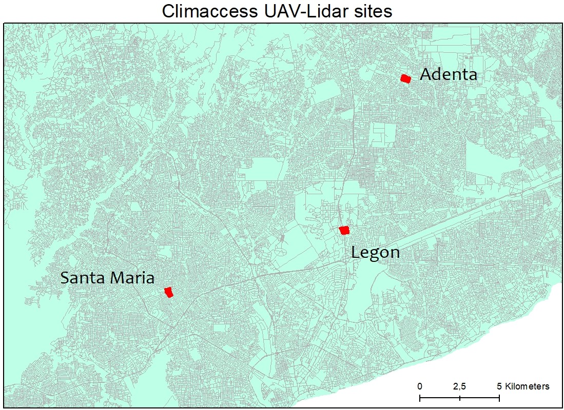
UAV-based Lidar data collection has taken place as planned in three selected areas for a period of 10 days following extensive preparations involving equipment, training, location scouting and legal aspects. The joint field work activities also involved ground truth mapping of flood prone locations for further validation of flood models.
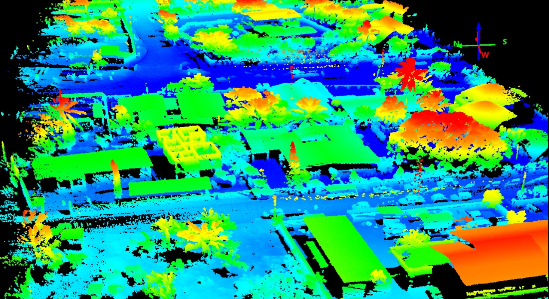
Example of a Lidar output:
Click here to watch a video of the UAV-based Lidar data collection in Accra.
Click here to see detailed track-log maps for the UAV-Lidar sites


Topics
CLIMACCESS PROJECT
Climate Change Resilience in Urban Mobility
Research Collaboration Partners:
 |