
Work on the CLIMACCESS survey has begun
After the last round of fieldwork in November, work has now begun on the CLIMACCESS survey. The survey is part of work package A and has as its objectives to explore urban mobility patterns and practices imbedded in the livelihood strategies of urban residents, within the context of climate change resilience, especially regarding increased impacts of flooding due to climate change. Data collection for the survey will commence in May, and we expect to collect 1000 responses in total from the four survey areas.
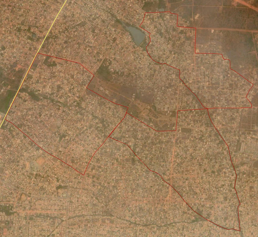
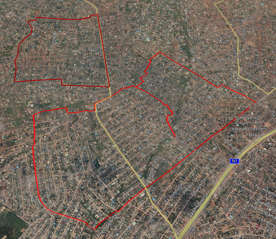
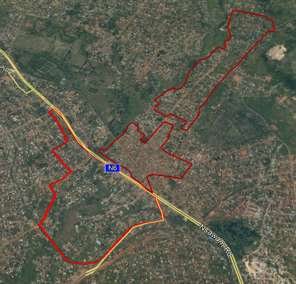
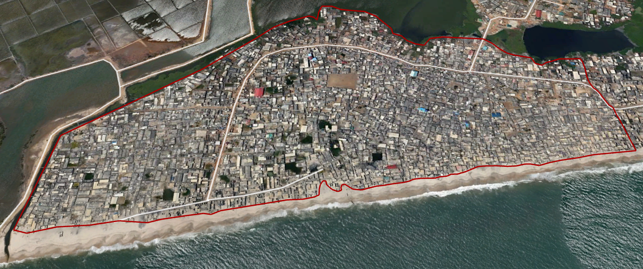
As part of the survey preparation process, the exact survey areas have been delineated and a geographic random sampling strategy has been developed. Click here to see a presentation of the sampling strategy prepared for training of enumerators.
Survey area overview

Adentan locality - peripheral, less accessible, middle-high income
Santa-Maria locality - semi-central, highly accessible, low-middle income, consolidated
Pokuase locality - peripheral, highly accessible, socially mixed, not fully consolidated
Glefe locality - semi-central, poorly accessible, low income, very high density
Topics
CLIMACCESS PROJECT
Climate Change Resilience in Urban Mobility
Research Collaboration Partners:
 |